Ride On: Guide to Cycling the Road Less Travelled
Oregon’s Tualatin Valley boasts many miles of bike paths, allowing for an exciting and invigorating day, weekend or week of discovery. From urban trails connecting cities to rural paths in the forest, there is no shortage of places to take the road less traveled.
SCENIC BIKING ADVENTURE FOR EVERY CYCLIST
Gear up for a delightful bike adventure in the heart of Tualatin Valley! With just a sprinkle of planning and a spark of pedal-power, you’re set for a ride that’s smooth, scenic, and superbly satisfying. Choose your journey from an array of cycling routes, each promising unique experiences for every level of cyclist. Take on the majestic Tualatin Valley Scenic Bikeway, featuring a 21-mile, car-free stretch along the Banks-Vernonia State Trail—perfect for those seeking a tranquil trail map to freedom. Or circle the stunning Henry Hagg Lake and meander through Scoggins Valley Park, where nature’s beauty is your constant companion. Whether you’re an experienced rider or just starting out, looking for an easy ride or a challenging scenic biking path, our valley offers endless opportunities to explore. From urban cycling through bustling streets to mountain biking on rugged trails, Tualatin Valley is your gateway to eco-friendly rides and unforgettable adventures.
Tualatin Valley Cycling Rides | Out Of County/Multi-county Rides
Skill Level: Easy | Moderate | Difficult
EASY
Henry Hagg Lake Loop
Miles: 10.34 miles road
For intermediate and advanced cyclists, this 10.3-mile ride is an easy pedal with low traffic and plenty of rest stops to take in views of Henry Hagg Lake and the Oregon Coast Range mountains. Bring a picnic lunch to enjoy after the ride, and on hot days, bring your swimsuit to take a well-deserved dip in the lake
Family-Friendly Banks-Vernonia State Trail
Miles: 13.61 miles paved
This car-free ride along the scenic Banks-Vernonia State Trail, a 21-mile rail-to-trail path, is great for families who want an easy pedal that has plenty of scenic and historic highlights, including the Buxton Trestle. Because it is an out-and-back, the ride can be extended or cut short as needed.
MODERATE
North Plains Farms & Forests Tour
Miles: 22.26 miles road
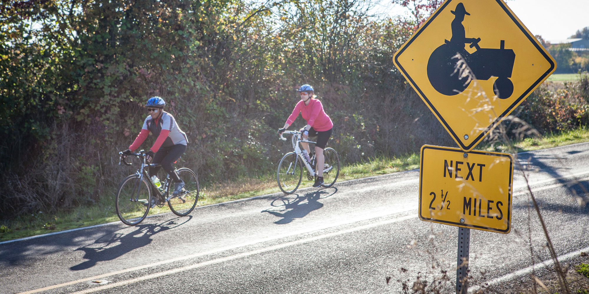
The North Plains Farms & Forest Tour is a lovely ride along low-traffic roads through scenic farm and forestland. The scenery feels different coming versus going, so don’t let the out-and-back nature of the route discourage you. With the modest elevation gain, this is a good option for beginner riders looking to go a little further.
Forest Grove to Coast Range Tour
Miles: 35.97 miles road
Tualatin Valley is scenically situated between Portland and the Oregon Coast, and the Oregon Coast Range is one of the natural boundaries that gives this valley its name. Ride along this 36-mile loop, where you will encounter breweries, wineries, nature…this ride has it all! With some decent mileage and elevation gain there are plenty of places to stop and take it all in.
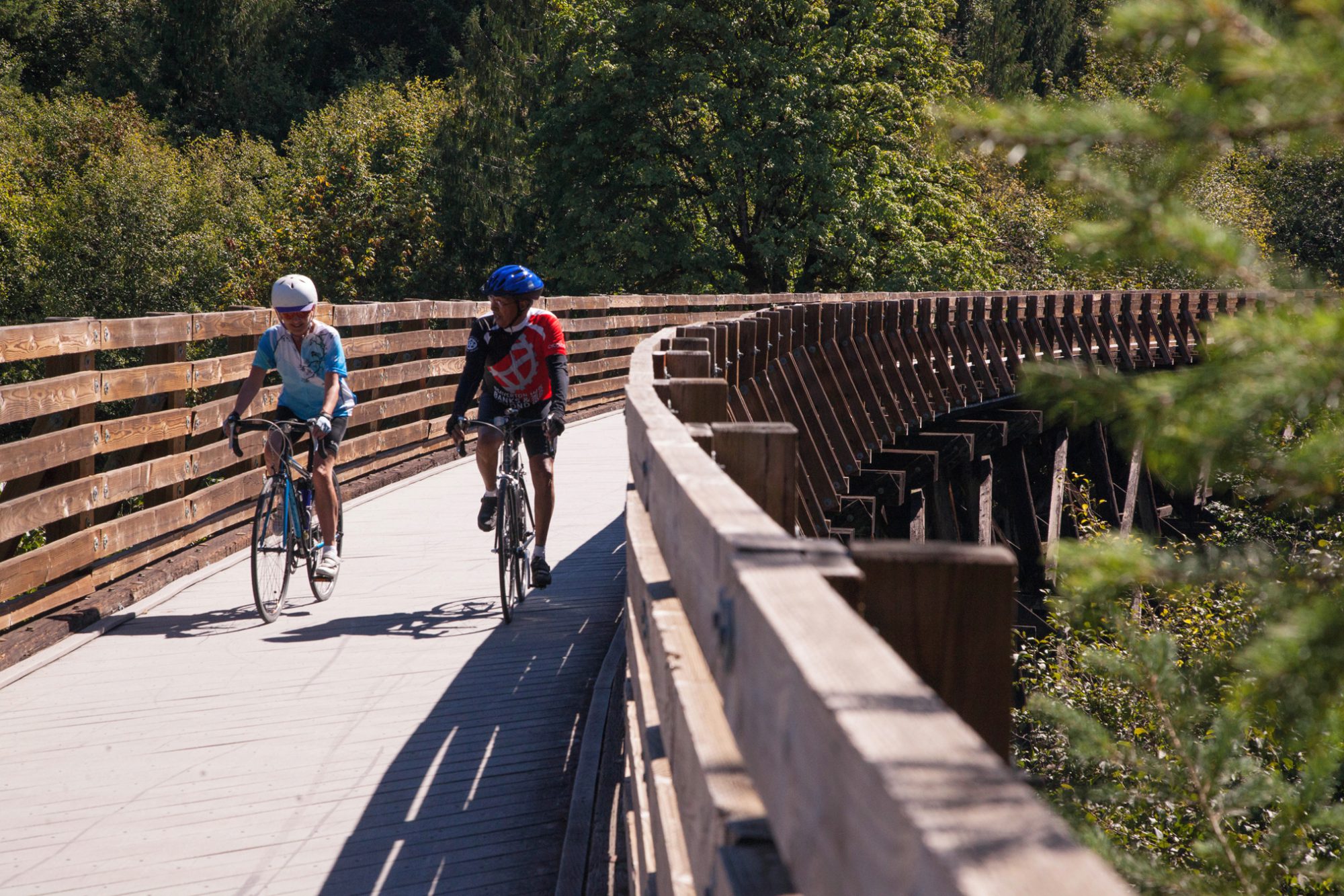
Banks-Vernonia State Trail
Miles: 41.82 miles paved
This trail will take you through open glades of the green, pine-scented forests and across babbling streams. Some of the area’s best wildflower and wildlife viewing is waiting for even the most casual of adventurer.
Built along an abandoned railway, this eight-foot wide, year-round, multi-use paved trail is popular among cyclists, hikers and equestrians.
Open to walkers, joggers, cyclists and horseback riders, the Banks-Vernonia State Trail was the state’s first rails-to-trails project, and it attracts tens of thousands of outdoor enthusiasts. The trail is open year-round, and tent and RV camping are available—also year-round—at L.L. Stub Stewart State Park.
DIFFICULT
Reehers Camp Loop
Miles: 17.66 miles gravel
The Reehers Camp Loop is for the skilled adventurer who wants to sample a little bit of everything the Oregon Coast Range has to offer: Rolling paved roads, quiet gravel double-track, and some fun single-track paths thrown in the mix.
Reehers Camp is a designated horse camp, and trails on this loop are single-track. Cyclists, please be aware that equestrians are also using these trails and cyclists should take great care not to alarm horses and equestrians
Western Tualatin Valley Car-Free Loop
Miles: 42.31 miles paved
Want to see the Tualatin Valley without having to hop in a car? That’s easy to accomplish with Portland’s MAX light rail. Hop on from Portland International Airport or downtown Portland to take a ride through the small town of Forest Grove, by a variety of farmland, around a serene lake, and past famous wineries.
Tualatin Valley Scenic Bikeway
Miles: 50.55 miles road/paved
The Tualatin Valley Scenic Bikeway captures the best of the northern Willamette Valley including friendly downtowns, fertile farmlands, lush natural areas and the Banks-Vernonia State Trail.
Intermediate and advanced riders love not only this scenic bike trail, but also the intriguing spots along the way. Pedal-happy visitors can spend a full day on the 50-mile bikeway, uncovering it all while also getting a stellar workout.
West Tualatin Valley Tour
Miles: 55.04 miles road
The West Tualatin Valley Tour is a big ride, but what a tour! There are plenty of amenities to keep you going as you roll through the communities of North Plains, Forest Grove, Gaston, and Cornelius. View old barns, stop at wineries, and explore more than a smattering of brewpubs make this a memorable ride.
North Tualatin Valley Car-Free Ride
Miles: 66.47 miles road
Get to the famous Banks-Vernonia State Trail from anywhere in the Portland Region via the MAX Light Rail. No car is needed to enjoy the beauty of the Tualatin Valley with your bike.
Out Of County/Multi-county Rides
DIFFICULT
Tillamook Forest Tour
Miles: 20.96 miles gravel
The Tillamook Forest Tour, used in Cycle Oregon’s gravel rides, challenges with variable surface conditions, and reward you with a backcountry adventure. Be prepared and you’ll enjoy mountain streams, wildflowers, and views of the Coastal Mountains.
Please note that a portion of this tour is along single-track trails also used by equestrians. Cyclists should take great care not to alarm horses and equestrians
Vernonia Coastal Mountain Tour
Miles: 28.88 miles gravel
This route is not for the weary heart. The first half of the route includes the majority of the elevation gain, but don’t fret the views of the Coastal Mountains will be well worth the trip. The route ends along Hwy 47, which does not have a wide shoulder; please use caution while on this portion.
Wine Country Ramble
Miles: 42.39 miles road
Come tour the countryside that inspired countless wineries and vineyards to locate in Tualatin Valley, in the northernmost part of the Willamette Valley wine region, as well as in Yamhill Valley, just south of Tualatin Valley. The rolling hills, farmhouses and open countryside will inspire you to come back again to visit your favorite wineries. The route does includes one mile of gravel near the middle of the ride.
Crown-Zellerbach Trail
Miles: 55.46 miles gravel
The Crown-Zellerbach (CZ) Trail is a new rails-to-trails project from the city of Scappoose to the city of Vernonia in Columbia County. Ride from the Multnomah Channel to the Oregon Coast Range and through lush forests. The trail is a multi-use trail; please watch out for walkers and equestrian users. Stay on the designated trail, as private property runs through and nearby.
Columbia County Challenge
Miles: 95.06 miles road
At nearly a century long, with more than 5 kilometers of climbing, this ride will test your legs. You’ll descend from the Oregon Coast Range down to the Columbia River on a route that displays Oregon’s stunning landscapes. The climb back to Vernonia is primarily along the Crown-Zellerbach Trail, an easy-climbing, car-free gravel route on a historic railbed.
Plan your Oregon’s Tualatin Valley Getaway
Discover the hidden gem of the Tualatin Valley, where nature, culture, and adventure await you this winter and spring. Order the latest Winter Inspiration Travel Guide from Explore Tualatin Valley and get ready to explore, taste, and enjoy this amazing destination.